


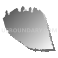
Wilson County--Lebanon & Mount Juliet Cities PUMA, Tennessee
About
Outline

Summary
| Unique Area Identifier | 193993 |
| Name | Wilson County--Lebanon & Mount Juliet Cities PUMA |
| State | Tennessee |
| Area (square miles) | 583.20 |
| Land Area (square miles) | 570.83 |
| Water Area (square miles) | 12.37 |
| % of Land Area | 97.88 |
| % of Water Area | 2.12 |
| Latitude of the Internal Point | 36.14847570 |
| Longtitude of the Internal Point | -86.29020970 |
Maps


Graphs
Select a template below for downloading or customizing gragh for Wilson County--Lebanon & Mount Juliet Cities PUMA, Tennessee


Neighbors
Neighoring Public Use Microdata Area (by Name) Neighboring Public Use Microdata Area on the Map
- Nashville-Davidson (East) PUMA, TN
- Rutherford County (North)--Smyrna Town & La Vergne City PUMA, TN
- Sumner County--Hendersonville City PUMA, TN
- Warren, Macon, Smith, DeKalb, Cannon & Trousdale Counties PUMA, TN
Top 10 Neighboring County (by Population) Neighboring County on the Map
- Davidson County, TN (626,681)
- Rutherford County, TN (262,604)
- Sumner County, TN (160,645)
- Wilson County, TN (113,993)
- Smith County, TN (19,166)
- DeKalb County, TN (18,723)
- Cannon County, TN (13,801)
- Trousdale County, TN (7,870)
Top 10 Neighboring County Subdivision (by Population) Neighboring County Subdivision on the Map
- District 33, Davidson County, TN (22,299)
- District 12, Davidson County, TN (20,753)
- District 11, Davidson County, TN (16,649)
- District 6, Sumner County, TN (14,535)
- District 9, Sumner County, TN (12,843)
- District 3, Sumner County, TN (12,840)
- District 2, Rutherford County, TN (12,397)
- District 3, Rutherford County, TN (12,027)
- District 8, Sumner County, TN (11,100)
- District 16, Wilson County, TN (8,797)
Top 10 Neighboring Place (by Population) Neighboring Place on the Map
- Nashville-Davidson metropolitan government (balance), TN (601,222)
- Hendersonville city, TN (51,372)
- Lebanon city, TN (26,190)
- Mount Juliet city, TN (23,671)
- Hartsville/Trousdale County, TN (7,870)
- Green Hill CDP, TN (6,618)
- Rural Hill CDP, TN (2,007)
- Watertown city, TN (1,477)
- Alexandria town, TN (966)
Top 10 Neighboring Elementary School District (by Population) Neighboring Elementary School District on the Map
Top 10 Neighboring Secondary School District (by Population) Neighboring Secondary School District on the Map
Top 10 Neighboring Unified School District (by Population) Neighboring Unified School District on the Map
- Nashville-Davidson County School District, TN (626,681)
- Sumner County School District, TN (160,645)
- Rutherford County School District, TN (153,649)
- Wilson County School District, TN (84,298)
- Smith County School District, TN (19,166)
- DeKalb County School District, TN (18,723)
- Cannon County School District, TN (13,801)
- Trousdale County School District, TN (7,870)
Top 10 Neighboring State Legislative District Lower Chamber (by Population) Neighboring State Legislative District Lower Chamber on the Map
- State House District 57, TN (84,276)
- State House District 49, TN (81,804)
- State House District 60, TN (75,644)
- State House District 48, TN (75,364)
- State House District 45, TN (72,256)
- State House District 44, TN (70,843)
- State House District 46, TN (68,934)
- State House District 51, TN (62,965)
- State House District 40, TN (60,137)
Top 10 Neighboring State Legislative District Upper Chamber (by Population) Neighboring State Legislative District Upper Chamber on the Map
- State Senate District 16, TN (231,510)
- State Senate District 18, TN (222,166)
- State Senate District 17, TN (208,424)
- State Senate District 20, TN (194,112)
Top 10 Neighboring 111th Congressional District (by Population) Neighboring 111th Congressional District on the Map
Top 10 Neighboring Census Tract (by Population) Neighboring Census Tract on the Map
- Census Tract 309.01, Wilson County, TN (9,572)
- Census Tract 156.31, Davidson County, TN (8,758)
- Census Tract 156.10, Davidson County, TN (7,820)
- Census Tract 212.04, Sumner County, TN (7,434)
- Census Tract 301.01, Wilson County, TN (7,421)
- Census Tract 303.07, Wilson County, TN (7,135)
- Census Tract 405.01, Rutherford County, TN (6,989)
- Census Tract 212.01, Sumner County, TN (6,666)
- Census Tract 301.02, Wilson County, TN (6,640)
- Census Tract 405.02, Rutherford County, TN (6,609)
Top 10 Neighboring 5-Digit ZIP Code Tabulation Area (by Population) Neighboring 5-Digit ZIP Code Tabulation Area on the Map
- 37075, TN (59,256)
- 37129, TN (49,103)
- 37122, TN (46,463)
- 37066, TN (42,758)
- 37087, TN (41,132)
- 37076, TN (35,230)
- 37138, TN (22,191)
- 37090, TN (12,922)
- 37190, TN (8,787)
- 37074, TN (6,965)